Orient
Know where you are and where you're going.
Field Guide
Practical knowledge for better outdoor experiences.
Know where you are and where you're going.
Get clear, practical information before you go.
Rely on trusted, up-to-date details and official sources.
Respect the place, current conditions, and what you find.
Field Guide & User Manual
A practical guide to the current field-test build: map-first discovery, Water and Land wayfinding, mobile navigation, search, filters, collections, place details, Launch Suitability guidance, and verification notes.
The current v1.2 field-test runtime resolves 89 active places. Most are still part of the original water/paddle discovery use case, with a deliberately small green/mixed pilot added to test the broader BlueGreen model. Mixed destinations intentionally participate in both Water and Land discovery.
On larger screens, the map remains the central discovery surface while search, filters, collections, results, and place details sit alongside it. Use the map and list together: narrow the results, inspect markers, and open details without treating any single label as a guarantee.
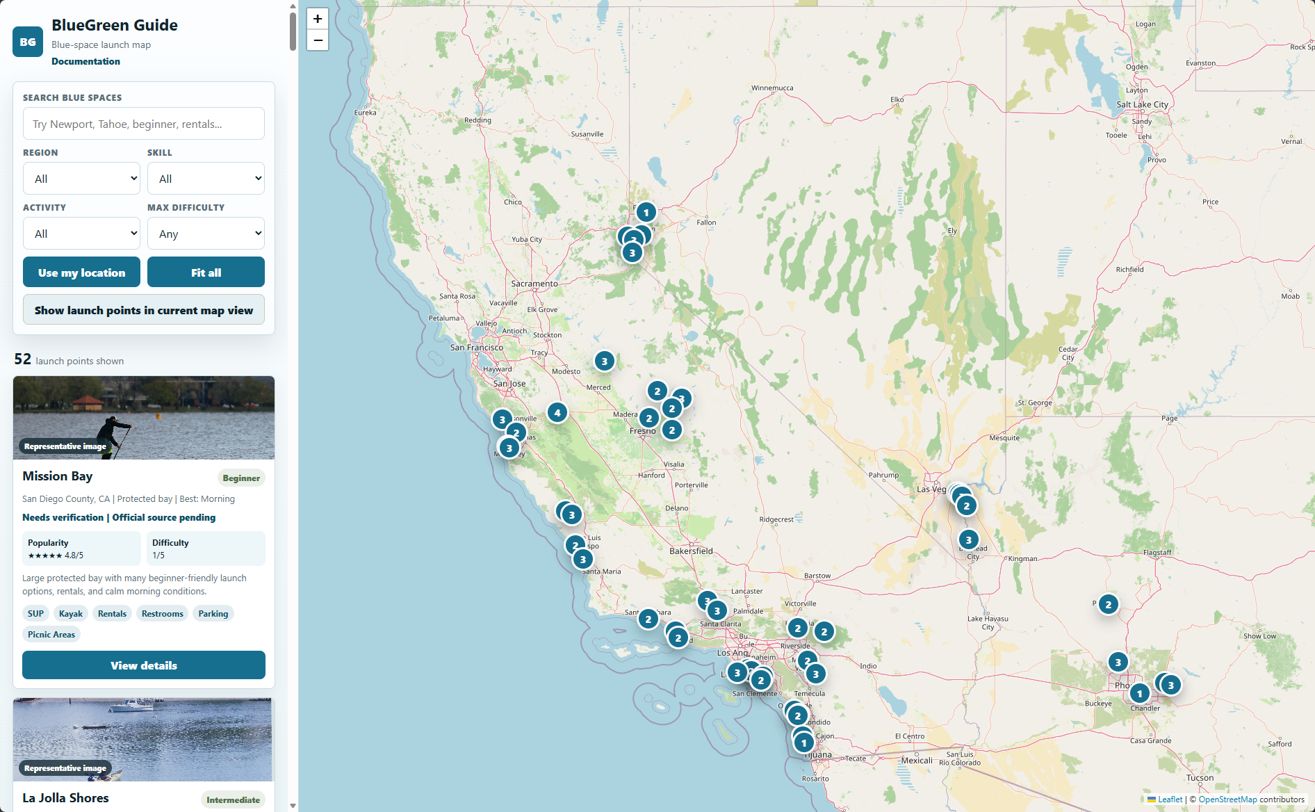
Use search, Water/Land discovery, curated collections, and additional filters to build a useful shortlist. Controls wrap for small screens rather than requiring horizontal scrolling.
Use the interactive map and compact map tools to understand where the current results are located. The first mobile Map view fits the current result set, a Fit control restores that overview, and the Layers control can show or hide BlueGreen Guide place markers.
Use browser geolocation when you want to orient discovery around your current area. Location permission and accuracy vary by browser and device.
Saved Places and My Trips are visual placeholders in the current field-test build. Nothing is stored yet and no account is created.
Open the User Guide, Quick Start, Blue + Green Spaces explainer, planning guidance, documentation home, and the current Settings placeholder.
Water is for water-centered places and activities. Land is for land-centered places and activities. Mixed is not a new brand color; it describes places with meaningful blue-space and green-space characteristics. Mixed places can appear in either relevant discovery filter.
Collections are editorial shortlists based on explicit place IDs. Selecting one filters the current results. Collections can be combined with search and applicable filters.
Pan and zoom, select markers, use the Fit control to restore the current result overview, toggle the BlueGreen places layer when useful, or filter around the visible map area. Blue markers communicate water semantics and green markers communicate land semantics. Mixed destinations use the appropriate blue/green semantics rather than a separate arbitrary color.
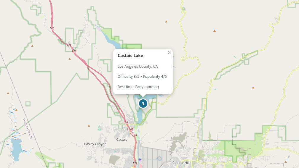
Search uses place names, aliases, regions, water bodies, taxonomy, activities, amenities, tags, descriptions, and paddle-suitability values where relevant. The same search should help whether you know a place name or only know the kind of experience you want.
Water/Land discovery is the broad environment-level filter. Paddle-relevant places also retain region, skill, water-activity, and maximum-difficulty filters. These can be combined with search and curated collections.
Place cards summarize the most useful information available for a record. Paddle-relevant cards may prioritize SUP Suitability, Difficulty, Wind Sensitivity, Typical Use, Staging Space, activities, amenities, and verification status. Green-space cards focus on the place and land-relevant information available in the field-test record.
The legacy numeric Popularity field may still exist internally during migration, but it is not the preferred user-facing crowd signal. Typical Use and Crowd Sensitivity communicate that planning context more directly.
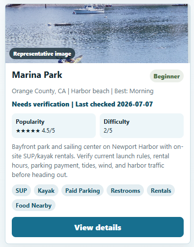
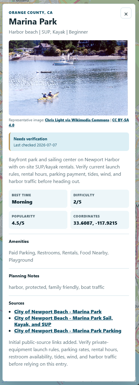
Open a place detail view for the fuller description, relevant planning fields, image information, source links, environment context, verification notes, and Launch Suitability fields where the place is paddle-relevant.
The Launch Suitability Profile is a paddle-specific planning layer. It helps compare paddle-relevant places but is not a live-conditions system or safety score.
Overall recreational stand-up paddleboarding fit: Excellent, Good, Fair, or Challenging.
How strongly increasing wind can degrade the paddling experience. It is not current wind data.
A general low-to-very-high use signal. It is not a live visitor count.
How much crowding can interfere with launching, staging, resting, or paddling.
Practical room for unloading, rigging, launching, exiting, and temporarily placing paddle equipment.
Confidence in the curated suitability assessment. It is separate from factual place verification.
Difficulty, Skill Level, and Best Time remain separate planning signals. Always compare them with current conditions and your own experience, equipment, and comfort level.
An official source link does not automatically verify every field. Access, legal activity areas, parking, fees, facilities, closures, water quality, fire restrictions, trail conditions, weather, wind, tides, and hazards may require separate current checks.
BlueGreen Guide intentionally favors transparency over assumptions. A managing agency may confirm that a park, launch, lake, trail system, or facility exists without confirming every operational detail in the record. The app keeps material uncertainty visible instead of converting partial evidence into a fully verified claim.
Verification status describes confidence in available place facts. It does not mean a destination is good, bad, safe, or suitable for every person.
Existing paddle records may use credited representative photography. New green/mixed field-test photography still needs verification in some cases. Treat image labels and credits literally: a representative image is not proof that the photo shows the exact access point or current conditions.
Markers aim to represent practical visitor, launch, shoreline-access, or trail-access locations where that can be reasonably supported. When an exact GPS point is inferred rather than published by an official source, it should be documented as representative rather than presented as an official waypoint.
Check current official access, parking, fees, hours, closures, permits, and local rules.
Review the current conditions relevant to your activity—weather, wind, tides, water quality, trail status, fire restrictions, or other advisories.
Consider experience, equipment, companions, mobility needs, and comfort level. BlueGreen Guide planning labels do not replace personal judgment or official guidance.